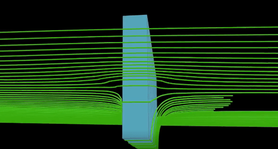
Path lines are used in many ways in fluid dynamics to visualise the movement of particles in a flow field. Based on the travel times and flow paths, catchment areas of drinking water catchments can be derived or the effectiveness of necessary hydraulic defence and remediation measures can be estimated. The PCGEOFIM programme uses the particle tracking method for the calculation of path lines. The particles used are moved at the distance velocity (vDar/ne) in the unsteady flow field. The particle tracking method shown in the video (Railway line calculation in 3D with PCGEOFIM) illustrates the dispersion of particles with the groundwater flow. In the vicinity of cut-off and sheet pile walls, but also underground compaction dams, a changed flow regime results in the accumulation and flow around such so-called hydraulic barriers. An essential criterion here is that the numerical model can adequately represent the flow around the barrier and that the particles used do not penetrate the barrier and get stuck in it. Such calculations are used primarily in groundwater remediation and in civil engineering measures that require intervention in the groundwater regime.

LEIPZIG COMPANY RUN 2023!
On 28 June 2023, IBGW and seecon Ingenieure took part in the Leipzig company run together. In total, more than


