Project details
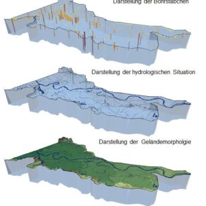
The study area comprises the Vereinigte Mulde between the towns of Wurzen (km 58+255) in the south at the level of the B6 road bridge and Eilenburg in the north (km 44+115) at the branch of the Mühlengraben. In the west, the boundary of the study area roughly coincides with the course of the B107 federal road. The eastern edge roughly corresponds to the course of the S19 rural road (Wurzen-Böhlitz).
Further information can be found under the link to the project page of the Saxon State Reservoir Administration (LTV):


